
About
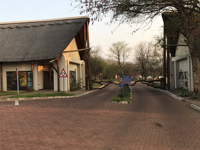
Phalaborwa is a town in the Mopani District Municipality, Limpopo province, South Africa. It is located near the confluence of the Ga-Selati River and the Olifants, halfway up along the western border of the Kruger National Park in the Lowveld. == Name == The name "Ba-Phalaborwa", given to the area by the Sotho tribes who moved here from the south, means better than the south. The Sotho mined and smelted copper and iron ore here as far back as 400 AD. Masorini, near Phalaborwa gate, is a reconstructed Ba-Phalaborwa hill village, with huts, grain storage areas, and an iron smelting site. == Surrounding townships == There are two townships, Namakgale and Lulekani where the Pedi and Tsonga reside, and rural areas such as Mashishimale, Majenje, Makushane and Ga-Maseke. == Mining == Phalaborwa began as a mining town and still is home to Palabora Mining. The massive open pit mine, nearly 2,000 meters across, is Africa's widest manmade hole. == Tourism == Tourism and wildlife play a dominant role in the life of this town. It is the only town in South Africa that borders the Kruger National Park, the Mozambiquan border is only two hours drive away. Lately, with the incorporation of various private game reserves into the conservancy area, Phalaborwa is all but enclaved by nature conservancies. SOURCESWikipedia
Safari Tours
Kruger Safari Package