About
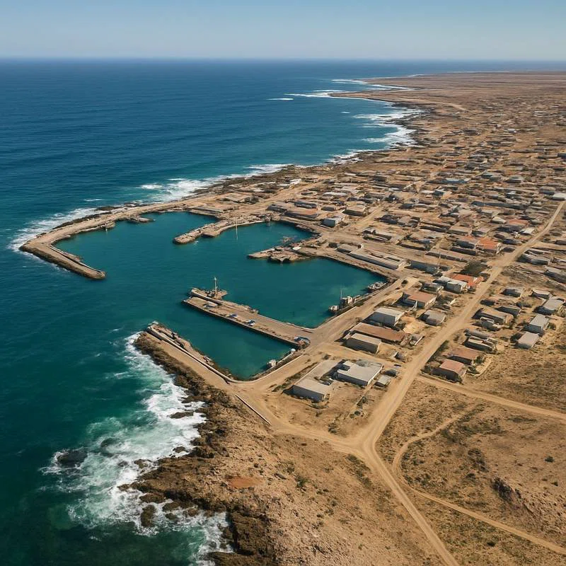
Port Nolloth is a town and small domestic seaport in the Namaqualand region on the northwestern coast of South Africa, 144 kilometres (89 mi) northwest of Springbok. It is the seat of the Richtersveld Local Municipality. The port was previously a transshipment point for copper from the Okiep mines, and diamonds from the Namaqua coast. Since the 1970s the principal seagoing activities have been fishing and small-vessel tourism. Today the town is a sleepy commercial hub with a number of holiday homes and a caravan park at the adjacent McDougalls Bay. It is also a gateway to the Richtersveld National Park, located 160 kilometres (99 mi) to the north along the Orange River. == History == The bay upon which the port sits was known by the indigenous Namaqua people as Aukwatowa ("Where the water took away the old man"). Its location was marked by Portuguese explorer Bartolomeu Dias on his epic voyage around the Cape of Good Hope in 1487. It was the last landfall he sighted before a wild storm blew his ship off course and out to sea for 13 days.The land surrounding the bay remained virtually uninhabited until James Alexander's discovery in 1852 of copper at Okiep, 160 kilometres (99 mi) inland from the bay. The Cape Colony administration immediately commenced a survey of the coastline to locate a suitable harbour from which to ship the copper ore. SOURCESWikipedia